Hurricane Erin has been upgraded to a dangerous Category 4 storm as its path threatens to impact the US East Coast and parts of the Caribbean, particularly the Bahamas and the Turks and Caicos Islands. While forecasts indicate that Erin may not make landfall, the storm is expected to unleash significant rainfall, with estimates of up to six inches (15.2 cm) in the islands already under tropical storm warnings.
Initially classified as a Category 5 hurricane due to its explosive rapid strengthening, Erin's intensity fluctuated before gaining strength once again. Areas in Puerto Rico have already felt the storm’s impact, with over 150,000 residents losing power from high winds damaging electric infrastructure. Local utility provider Luma reported considerable restoration progress, restoring power to 95% of affected customers by Sunday evening.
The outer bands of Hurricane Erin are beginning to affect the Bahamas, leading to emergency advisories from the Bahamas’ Disaster Risk Management Authority. Its managing director, Aarone Sargent, urged residents to familiarize themselves with nearby shelters ahead of the storm's arrival, emphasizing that hurricanes are unpredictable and can change course without warning.
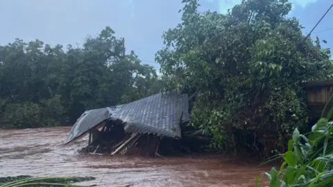
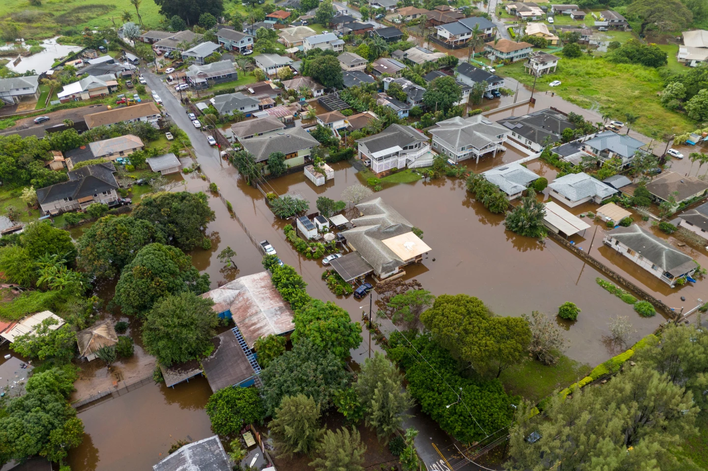
According to the National Hurricane Center (NHC), Erin is projected to pass east of the southeastern Bahamas and then navigate between Bermuda and the US East Coast by midweek. A large storm surge and high winds are anticipated for areas like the Outer Banks in North Carolina, prompting mandatory evacuations particularly for Hatteras Island, where officials warned of potentially impassable roads due to storm conditions.
As Hurricane Erin continues to grow in size and strength, forecasters remain vigilant, warning of dangerous rip tides and surf conditions expected to affect the entire East Coast of the United States. Evacuation orders and safety preparations are critical as communities brace for the storm's arrival.