MIAMI (AP) — Dangerous tropical weather brewed Saturday in the Atlantic Ocean with Humberto intensifying into a powerful Category 4 hurricane and a weather system taking aim at the Southeast U.S.
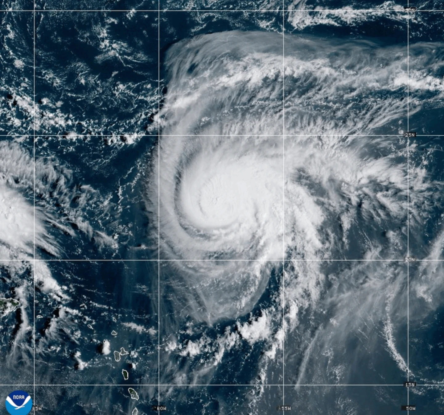
Hurricane Humberto had maximum sustained winds of 145 mph (230 kph) Saturday, according to the Miami-based National Hurricane Center’s latest advisory. The storm was located about 375 miles (605 kilometers) northeast of the northern Leeward Islands, moving west at 6 mph (9 kph).
Humberto could create life-threatening surf and rip currents for the northern Leeward Islands, the Virgin Islands, Puerto Rico, and Bermuda over the weekend, forecasters warned.
Meanwhile, a separate weather system likely to develop into a tropical storm over the weekend is threatening parts of the Bahamas and Cuba with heavy rainfall and flash flooding. Parts of the Bahamas are under a tropical storm warning as of Saturday.
This weather system is projected to approach the Southeast U.S. early next week, with forecasts indicating it will become a hurricane by late Monday.
South Carolina's Governor Henry McMaster declared a state of emergency, emphasizing the need for readiness amid uncertainty. Preparations in Charleston include coordination with local and federal authorities and gathering essential supplies as officials brace for potential flooding.
“Even though this has not formed yet, we are treating it as if we are expecting some kind of impact,” Chief Fire Marshal Michael Julazadeh stated during a Charleston City Council meeting.
In the Dominican Republic, the storm's remnants have caused serious flooding, prompting evacuations and declaring red alerts. Officials reported hundreds displaced and critical rescues as rivers overflowed, isolating communities.
In the eastern Atlantic, the center of post-tropical cyclone Gabrielle has moved away from the Azores, eliminating warnings for the region while still causing hazardous conditions with rip currents expected to affect parts of Portugal and neighboring areas.
In the Pacific, Hurricane Narda was recorded about 1,025 miles (1,650 kilometers) west-southwest of Baja California, expected to maintain strength but forecasted to weaken as it moves.